Published on July 7, 2021
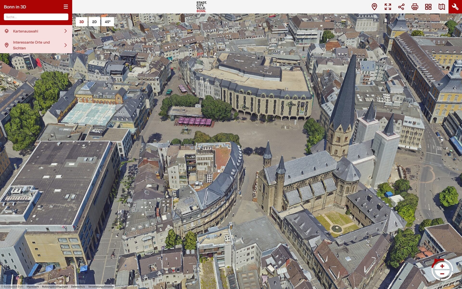
Experiencing and exploring the city from a bird's eye view and being able to fly over it in free 3D navigation gives urban society attractive new possibilities for local information.
Functions
Bonn's most important sights can be navigated directly, e.g. for tourism and congresses. This creates an attractive overview of the spatial context for those unfamiliar with the city. But long-time residents will also enjoy using and rediscovering their city from a bird's eye view.
Using the practical "Recommend section" function, application scenes can be sent directly to other people or integrated as links in web pages. The "Shadow function" can be used to simulate the shadows cast by buildings and vegetation at any time.
Three-dimensional "line and area measurements" for roofers and builders, for example, are other very useful functions.
Moving images can also be generated using the so-called "film flap function" via screen video, e.g. to fly around an object area and view it from all sides. The "cut surface function" allows the visualization of a terrain level, which can be useful for simulating flood events near the Rhine, for example.
In addition to the 3D city model, 10,122 oblique aerial photographs from the four cardinal points are also made available for viewing, which represents an enormous treasure trove of city documentation.
The official 2D city map of the federal city and an address search function for comprehensive spatial orientation round off the offer.
It was also particularly important to the city to include the beautiful scenery outside the city limits, especially the Siebengebirge with its digital terrain model. This provides very realistic distant views.
Role within the digital strategy of the City of Bonn
"The 3D city model in the form of the 3D mesh is positioned by the city in its Smart City strategy as the first basic building block of a 'digital representation' of the city's morphology and as the basis for future 'digital twins'," explain Chief Digital Officer Friedrich Fuß and Jochen Wagner, Head of the Office for Land Management and Geoinformation, which created the 3D model.
In further development stages, new planned urban development projects and building models in particular will be able to be used in this digital representation, which would make "Bonn in 3D" a useful tool for public participation and the planning and construction discourse as a whole. The desired vision is to be able to visualize all future significant plans, i.e. the Bonn of the future, in a freely accessible 3D city model.
The 3D city model is to be updated every two years from 2022 in order to ensure that this central source of information is sufficiently up-to-date for all municipal processes.
Technical background
The "Bonn in 3D" application is thanks to the enormous progress made in aerial photogrammetry.
Since 1997, the Office for Land Management and Geoinformation of the City of Bonn has had high-resolution aerial photographs taken at least every three years, usually in cooperation with the Bonn municipal utilities or the state surveying administration. These results have previously been used in two-dimensional geo-information systems and now form an indispensable basis for almost all of the city administration's work processes.
In 2019, oblique aerial images were recorded for the first time in addition to the usual vertical aerial images. Photogrammetric algorithms are used to calculate three-dimensional "point clouds" from this digital image material, which are then bundled into small spatial triangles with color values. These results are referred to as "3D mesh". This results in very large amounts of data, around 3 terabytes in Bonn.
The streaming and graphics technologies of modern internet browsers now enable access to this data and functions for everyone. The application runs on a smartphone, tablet or PC with a graphics card and modern browser. But be careful! Considerable amounts of data are transported in streaming, so an appropriate network connection and flat rate are recommended.
The aerial photography and photogrammetric analysis was carried out by Aerowest, Dortmund. The functionally sophisticated web application was provided by Geoplex GmbH, Osnabrück.
The 3D model can be found on the Internet at https://3d.bonn.de (opens in a new tab).